|
|
|
|
|
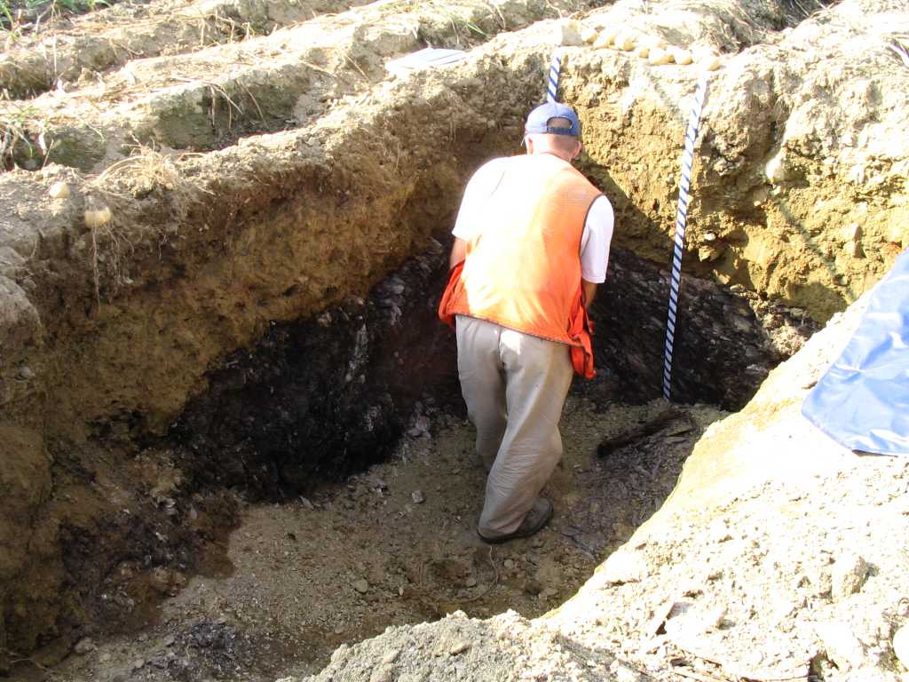
Results and Write-up for September 16th, 2004 joint MAPSS/MASE Workshop The first two photos below are from soil pit #1. The parent material is glacial till overlying residuum. Note how easily the backhoe dug through the "bedrock".
Dave Turcotte is standing next to the soil pit, and several potatoes can be seen on the ground surface. The Ap horizon is 8 inches thick, below which lies a cambic horizon to
28 inches below surface (b.s.), underlain by a IICr horizon of residuum. At ~52 inches b.s., hard bedrock was encountered (R horizon). Textures were SIL throughout the profile
and friable consistence. The IICr and R were lime-seamed, highly weathered and fractured, soft, phyllite.
The following 2 photographs are from soil pit #2. This was classified as a Lamoine soil. In the first photo, Don Phillips and Andrew Carpenter are in the soil pit. NRCS soil specialist Dave Wilkinson explains soil struture in marine sediments, while Bill Hersey and George Bakajza take notes. (unknown soil scientist to left). 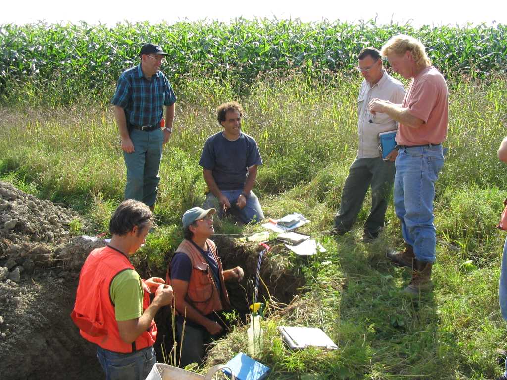 In the photo below, Don Phillips wets the soil profile in order to measure accurate colors. This was a nice, typical Lamoine soil, with an Ap horizon and then a series
of Bw horizons, a BC horizon, and then increasingly firm and finer-textured (verging to SICL) C horizons. Redox features were observed beginning at 10 inches b.s. and extending
down to below the base of the soil pit.
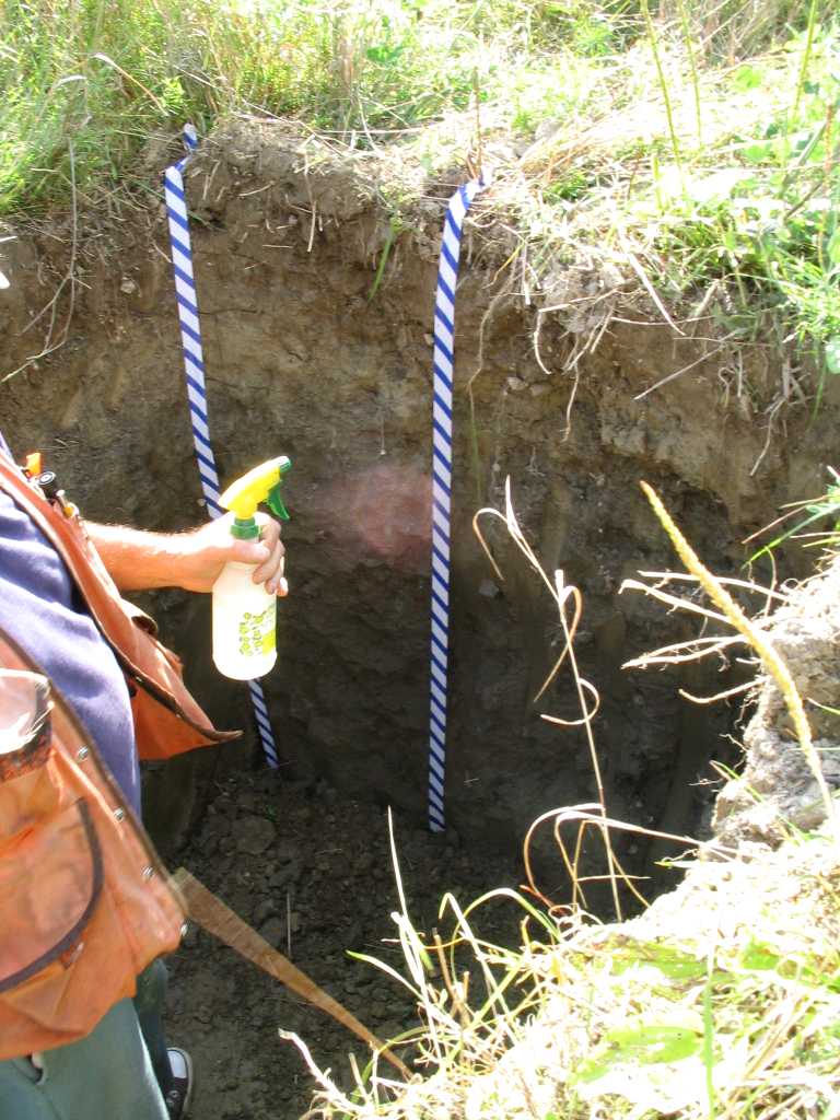
In the photo below, Don Phillips wets the soil profile in order to measure accurate colors. This was a nice, typical Lamoine soil, with an Ap horizon and then a series
of Bw horizons, a BC horizon, and then increasingly firm and finer-textured (verging to SICL) C horizons. Redox features were observed beginning at 10 inches b.s. and extending
down to below the base of the soil pit.
The only photo from soil pit #3, shown below, best fit into the Salmon soil series, but would most likely by described as a VARIANT because we found redox features at 25 inches b.s., making the drainage class MWD. However, there was some discussion as to whether the redox features were relict and that agricultural activities over the last two centuries might have improved the drainage at this site. Note the bright Bs horizons (and possibly remnant/disrupted albic material). Textures ran FSL down to the C horizon which was finer, SIL, and then stratification was evident in the 2C1 and 2C2 horizons, where LVFS/FS/MS alternated. 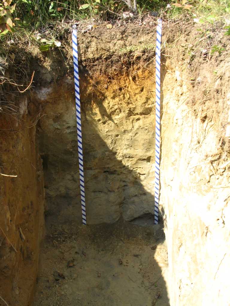
If any members have more photos or discussion to add, please E-mail below. |
|
© 2005 MAPSS, All rights reserved. Contact: info@mapss.org
[ Site Developed by Kenbrio ] |
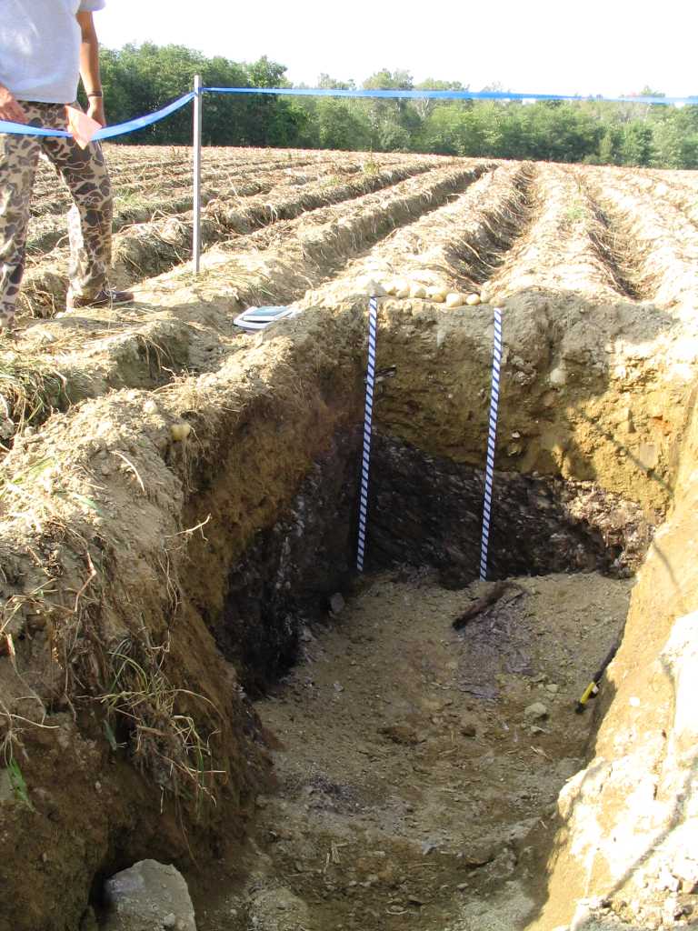 The second photo from Pit #1 shows Jay Raymond measuring the IICr horizon depth. Note the absence of coarse fragments in the potatoe land. We concluded that the Laurentide
Ice Sheet "tippy-toed" across this landscape.
The second photo from Pit #1 shows Jay Raymond measuring the IICr horizon depth. Note the absence of coarse fragments in the potatoe land. We concluded that the Laurentide
Ice Sheet "tippy-toed" across this landscape.